Jamaica Rivers
Jamaica Rivers - With their beginnings in the mountainous areas, Jamaica's rivers are many and varied - they can be found throughout the island from different points and destinations on their way to the Caribbean Sea.
Trip A Day Giveaway!The Alligator Pond River is a bathing spot a couple of miles west of Alligator Pond village off the road leading to Port Kaiser in the parish of Manchester.
Find the best Attractions in Saint ElizabethThe Black River is one of the longest rivers in Jamaica. It runs 53.4 km (33.2 mi). It was considered to be the longest until it was discovered that the Rio Minho was longer at 92.8 km.
Its name refers to the darkness of the river bed caused by thick layers of decomposing vegetation. Over 100 species of birds have been recorded in the Black River morass
|
The Broad River of Jamaica and flows in the Black River at the Great Morass in St Elizabeth. |
Jamaica Rivers
The Cane River rises at twin sources in the vicinity of Derby Peak in Eastern St Andrew at Bull Bay in the parish of Saint Andrew from where it flows south to the Caribbean Sea.
The Great River is one of Jamaica’s major rivers and forms the boundary of the parishes of St James, Westmoreland and Hanover.
The Guava River rises just north of the Grand Ridge of the Blue Mountains on the border of Portland St Thomas Jamaica. From here it runs east then north and then east again to its confluence with the Rio Grande.
|
Gut River is a river, beach and small hamlet on an isolated stretch of south facing coastline in Manchester Jamaica. The name is said by the locals to derive from the German word for good. |
Jamaica Rivers
The Martha Brae River is is located in Trelawny Parish on the north coast of Jamaica, towards the western edge, about 6 miles south of Falmouth, Jamaica.
The river features rafting. A small village west of the river is named Martha's Brae after the river.
|
The Negro River Jamaica is located on the south east coast of Jamaica in St Thomas parish. Going downstream it eventually connects to the Yallahs River in St Thomas. |
The source of the Rio Cobre is unclear on the best map available; the headwaters being a writhing of unnamed, seasonally dry tributaries. The highest of these rise just above the 1,750 feet (530m) contour. From here it flows to meet the Caribbean Sea in the northwest corner of Kingston Harbour.
Its most significant feature is perhaps the gorge through which it runs between Bog Walk under Flat Bridge and northern Spanish Town in St Catherine.
Find the best Port Antonio Attractions hereJamaica Rivers
The Rio Grande is a popular river of Portland parish Jamaica. It was named when the Spanish occupied Jamaica in the 15th and 16th centuries.
One of the largest rivers in Jamaica, it was named "Big River" (Rio Grande) by the Spanish, and today is one of the many tourist attractions in Portland, mainly for rafting.
|
The Rio Minho is the longest river in Jamaica at 92.8 km (57.7 mi). It rises close to the island's geographic centre, flows generally south-southwest and reaches the Caribbean sea at Carlisle Bay in the central south coast, to the west of the island's southernmost Portland Point St Elizabeth. The town of May Pen, Clarendon lies on the banks of the Rio Minho River. |
The Yallahs River is in the parish of St Thomas Jamaica. Major landslides have developed in the Upper Yallahs River Watershed. As a result, the river carries a greater silt load and scours its banks far more quickly.
The Yallahs Ford downstream has widened tremendously, leaving the coastal route vulnerable inundation after heavy rainstorms.
The area of Yallahs got its name from Captain Yallahs, a 1671 privateer who loved the area and visited frequently.
Find the best deal family hotels in Negril hereThe Stony River rises just north of Coopers Hill in Saint Catherine Parish Jamaica. From here it flows primarily north until it reaches its confluence with the New River.
Jamaica Rivers
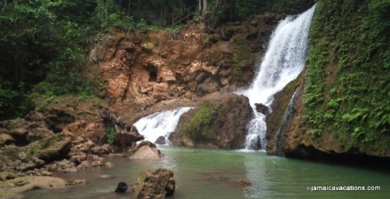
The YS River is a river found in the southern parish of St Elizabeth Jamaica. It and feeds the famous YS Falls, a popular tourist attraction near Middle Quarters.
 The YS River feeding the YS Falls
The Plantain Garden River is a river in the parish of St Thomas Jamaica. It is the only major river in Jamaica that does not flow in a northerly or southerly direction.
The Pagee River rises on the south eastern flank of Berry Hill (a 1,655 ft (504 m) summit) just below the 1,000 ft (300 m) contour at near Crawle Pen in St Mary.
It reaches the sea 14 miles (23 km) later at Pagee Beach) also in Saint Mary.
Find the best Attractions in Saint ElizabethJamaica Rivers - One Eye River is a tributary of the black River and runs in the parishes of Manchester and St Elizabeth.
Information on this page courtesy of wikipedia
Return from jamaica rivers to Jamaica Information
My Jamaica Blog keeps you up to date with news and reviews of the Best of Jamaica please subscribe below. Thanks, see you again soon.


New! Comments
Have your say about what you just read! Leave me a comment in the box below.